Structure Detection for Property Assessment

Find the structures your data misses

Parcel-Sense uses computer vision and parcel-aware spatial logic to detect structures directly from aerial imagery. Surface buildings that exist on the ground but are missing, misattributed, or incorrectly recorded in parcel data.

15¢ Per parcel scanned
$2,750 Minimum run charge
1,000 Free Trial scan for qualified jurisdictions
Parcel-Sense structure detection imagery preview
Detected Structure
Accessory Building
Production Scanning County-scale Built for repeatable parcel runs, structured outputs, and practical review workflows.
Assessment Ops
GIS Review
Parcel Audit
Aerial Imagery
Spatial Reconciliation
The Problem

Property records drift. The ground truth does not.

Jurisdictions can have parcels where structures are missing from records, attributed to the wrong lot, or carried forward after the building is gone. Manual review is expensive. Broad imagery scans without parcel context create noise. Parcel-Sense is built to narrow review time onto the parcels that actually matter.

Missing Improvements

Buildings can exist on the ground but fail to cleanly appear in parcel records, especially when legacy data, workflow gaps, or attribution issues stack over time.

  • Structures absent from records
  • Accessory buildings overlooked
  • Field review stretched too thin

Misattribution Across Boundaries

Raw detection alone is not enough. A structure that appears on one parcel may already be correctly recorded on an adjacent lot. Without boundary-aware logic, reviewers waste time on explainable detections.

  • Neighbor spillover and adjacency noise
  • Multi-parcel building layouts
  • False audit signals without context

Recorded Data No Longer Matches Reality

Datasets can hold onto old assumptions. Demolitions, reconfigurations, and changes on the ground can leave records lagging behind what imagery now shows.

  • Legacy data carried forward
  • Demolition or absence flags
  • Review lists that are too broad
Single-file One CSV with one row per parcel with detections and possible related parcels.
Parcel-aware Designed around parcel boundaries instead of naive tile scans
Actionable Outputs intended for actual review queues and screening
Scalable Built for large parcel runs, not just isolated one-off checks
Core Capabilities

Structure detection built for real property assessment workflows.

Parcel-Sense is centered on one job: determine whether structures are present on the ground, and where those structures truly belong in parcel context. The system is geared toward practical scanning, triage, and follow-up.

Direct Structure Identification

Detect primary and accessory structures directly from aerial imagery instead of relying exclusively on existing records, permits, or manual discovery.

Parcel-Level Spatial Reconciliation

Align detections to parcel geometry so structures can be interpreted in the correct cadastral context rather than as isolated image events.

Adjacency Validation

Check neighboring parcels to explain away edge cases, multi-parcel layouts, and boundary conflicts before they reach a human reviewer.

Presence and Absence Screening

Support review not only for parcels that appear improved, but also for parcels where the imagery suggests recorded structures may no longer be present.

Review-Ready Outputs

Turn model signals into structured parcel-level output that can be screened, filtered, and prioritized by field teams, analysts, or internal review staff.

High-Confidence Triage

Focus attention on parcels with the clearest divergence between imagery and recorded data so staff time goes where it has the highest value.

1

Provide Parcel Set

Send the parcel list or area to scan. A free 1,000 parcel run is available for qualified first-time evaluations.

2

Run Structure Scan

Imagery is processed to identify structures, evaluate spatial fit, and screen for parcels where recorded conditions may not align.

3

Apply Parcel Logic

Neighboring parcels and parcel boundaries are used to suppress explainable detections and improve audit quality.

4

Deliver Review Set

Receive a structured output focused on likely mismatches, ready for internal assessment, field screening, or follow-up analysis.

Results & Logic

Detection that survives parcel reality.

Parcel- Sense uses spatial adjacency logic to filter out noise, ensuring reviewers only spend time on meaningful data mismatches.

1
Noise Suppression Adjacency logic filters out neighboring lot bleed and explainable detections.
2
Data Mismatch Highlighting divergence between recorded assessment records and current imagery.
3
Operational Fit Outputs are structured for immediate insertion into appraisal and review queues.
Scale Independence

Big or Small, Parcel-Sense Handles it all

We have trained a resnet-18 CNN to define region(s) of interest on large parcels to zoom into to better validate detections across all models.

Commercial Structure

Straight pricing for serious parcel runs.

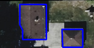
Parcel-Sense is priced to support meaningful operational scans, not one-off gimmicks. The current rate is 15 cents per parcel with a $2,750 minimum run charge. For qualified first-time evaluations, a free 1,000 parcel scan can be used to demonstrate fit before a larger run.

15 cents per parcel Simple unit economics for jurisdiction-scale scanning and repeatable review workflows.
$2,750 minimum run charge Designed for real operational scans rather than lightweight hobby-level requests.
Free 1,000 parcel scan Available as an entry run for organizations evaluating value and workflow fit.
Structured outputs Built for screening, review, field follow-up, and internal parcel audit workflows.
One-time or recurring runs Use for targeted initiatives, pilot programs, or repeat county-scale evaluation cycles.
Built around actual parcel review The emphasis is not raw imagery novelty. It is usable review intelligence.
Why Parcel-Sense

Built to be more useful than generic image detection.

A broad image detector can show something interesting. A parcel-aware system can show something operationally useful. That distinction matters when reviewers are deciding where to spend their time.

mpare-grid">

Generic scan output

  • Finds shapes in imagery without understanding parcel context
  • Creates review noise where adjacent parcels explain the signal
  • Often requires heavy manual interpretation before it becomes useful
  • Can produce flashy visuals without a workable audit queue

Parcel-Sense output

  • Focuses on whether structures are present and where they actually belong
  • Uses parcel boundaries and adjacency logic to suppress explainable signals
  • Turns imagery evidence into more usable parcel-level review candidates
  • Built for property assessment workflows rather than generic computer vision demos
FAQ

Frequently Asked Questions.

What does Parcel-Sense do?

It scans parcel imagery to determine whether structures appear present on the ground and flags parcels where imagery and recorded data may not align.

What is the pricing?

The price is 15 cents per parcel with a minimum run charge of $2,750. Qualified first-time evaluations may request a free 1,000 parcel scan.

Is this just raw image detection?

No. The system is designed around parcel-aware review logic so detections can be interpreted in actual cadastral context instead of as isolated image events.

What kinds of issues can this help surface?

It can help identify parcels where structures appear to exist on the ground but are missing, misattributed, or otherwise not aligned with recorded parcel data.

Get Started

Request a free 1,000 parcel scan.

If you want to see how Parcel-Sense fits your workflow, start with a free 1,000 parcel evaluation. For larger operational runs, pricing is 15 cents per parcel with a $2,750 minimum run charge.

Email: jarrettwilliams437@gmail.com
Service: Parcel structure detection and review screening
Pricing: $0.15 per parcel, $2,750 minimum run